Attractions to Visit

Image 1
Sites and Castles+1

The Sill: National Landscape Discovery Centre

Sites and Castles, Galleries and Museums

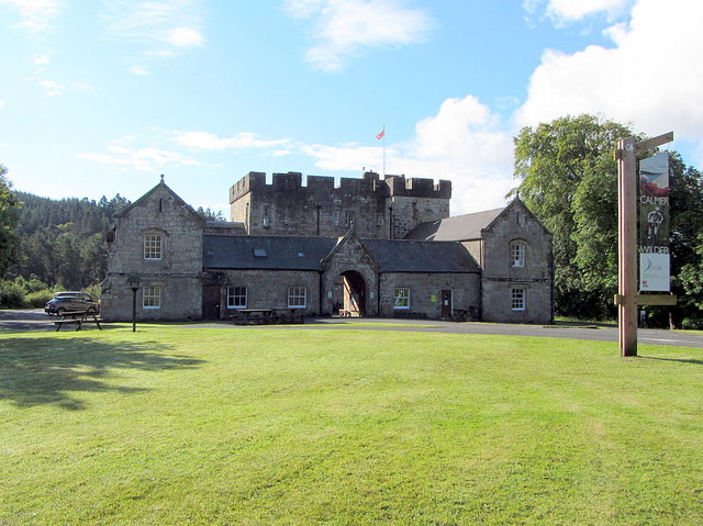
The Sill: National Landscape Discovery Centre is Northumberland National Park's visitor centre that will excite and inspire people of all ages to explore the landscape, history, culture and heritage of Northumberland. The Sill features exhibitions, learning and event spaces, a local food café, a world-class Youth Hostel and a shop specialising in local crafts and produce.
Image 1
Rivers and Lakes+1

Windermere Ferry

Rivers and Lakes, Nature and Wildlife

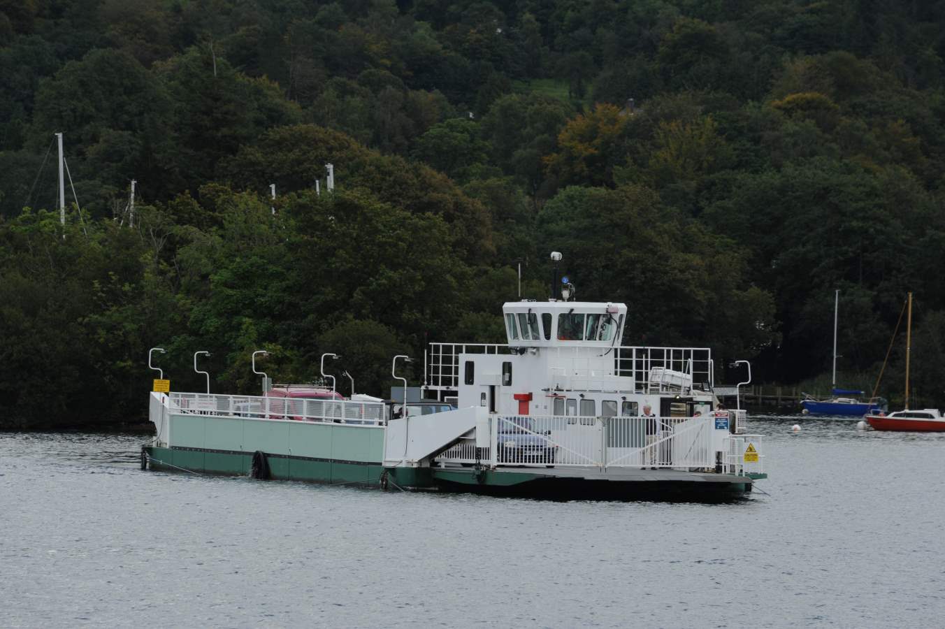
The Windermere Ferry is a vehicular cable ferry which crosses Windermere, the largest lake in England and located within English county of Cumbria.[1] The ferry route forms part of the B5285 road and crosses the lake at about its midpoint, from Ferry Nab in Bowness-on-Windermere to Ferry House at Far Sawrey, a distance of some 490 metres (540 yd). The ferry is owned and operated by Westmorland and Furness Council. The ferry operates all year, with services every 20 minutes from early morning to mid-evening. Each crossing can carry up to 18 cars and over 100 passengers and takes less than 10 minutes. A toll is charged. If the ferry is not operating, the alternative is a road journey of approximately 15 miles (24 km) around either the head or foot of the lake. The historic county boundary between Lancashire and Westmorland runs down the western shore of the lake and also along about three miles (5 km) of the southern section of the eastern shore. Anyone crossing the lake from east to west on the Windermere Ferry thus travels from the historic county of Westmorland to that of Lancashire.
Image 1
Culture and Heritages+1

Glenluce Abbey

Culture and Heritages, Sites and Castles

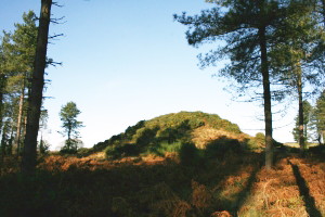
Dunragit's name means 'fort of Rheged' (Rheged was a kingdom covering parts of Northern England and South West Scotland) and the fort allegedly looks over Piltanton Burn. Dunragit's history is a long one and we have evidence of human habitation here dating back to the Stone Age. Relatively recent excavations found 3 huge concentric timber (as opposed to stone) circles with the largest being six times bigger than Stone Henge (yes, THE Stone Henge). The circular structure is thought to date from 2500 BC and can be found between Dunragit village and Droughduil Mote, though it is hard to see anything at all. Droughduil mote itself had some excavation work taken out on it and was found to date from a similar period as the timber circles - perhaps a viewpoint to look down on ceremonies taking place in the circles? Later in the villages history, Romans built their road through and it is thought there may be a Roman cemetery here. In the 18th century Dunragit's core was Dunragit House and the main employer was the now abandoned creamery.
Image 1
Culture and Heritages

Dunskey Gardens

Culture and Heritages

Amidst 2000 acres of spectacular Scottish countryside sits Dunskey Estate. A sprawling sanctuary, home to an Edwardian castle, luxurious lodges and panoramic views of the land and sea, it’s the perfect environment for both large group getaways and small intimate gatherings. Our team works only with trusted partners to transform the estate into your dream destination. Whether you’re looking to reconnect in nature with coworkers, loved ones, or even yourself, we’ll take care of all planning and coordination that goes along with your stay.
Image 1
Culture and Heritages+2

Castle Kennedy Gardens

Culture and Heritages, Sites and Castles, Galleries and Museums

The gardens surround the ruined castle of Castle Kennedy and Lochinch Castle (the current home of the Stair family). Huge rhododendrons dominate the garden as well as exotic palm trees. There are two lochs within the grounds which provide a home for geese, swans and ducks.
Image 1
Rivers and Lakes+3

Aldouran Glen

Rivers and Lakes, Nature and Wildlife, Walks and Activities, Historic places

Aldouran Glen consists of a wetland area with ponds, a boardwalk over marshland and a bird hide as well as the woodland owned by the Woodland Trust. There is a circular walk that can be completed through the woodland up the hill with magnificent views on the way down to village.
Image 1
Rivers and Lakes+2

Broad Law

Rivers and Lakes, Architecture and Art, Nature and Wildlife

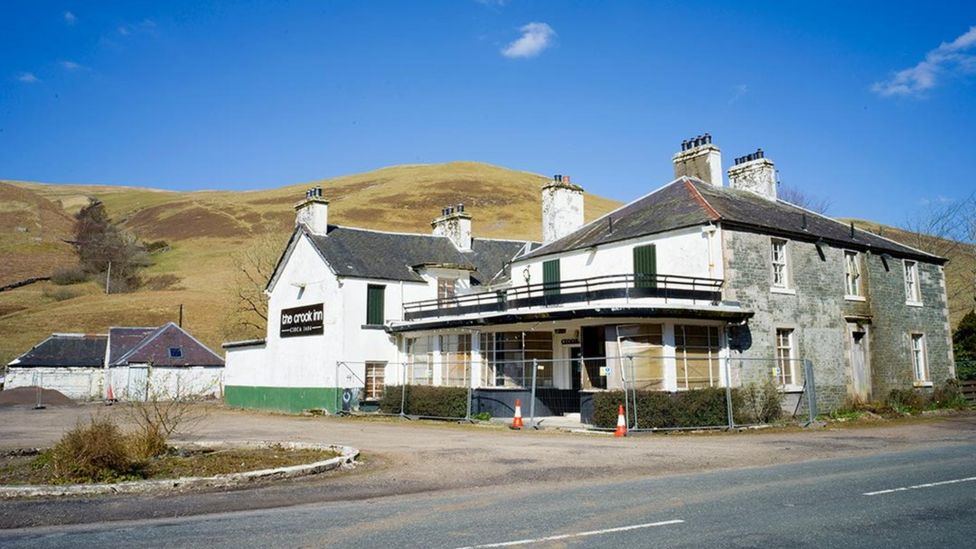
Broad Law is the highest hill in the Scottish Borders at 840m. Its gently mossy slopes are topped with the highest air traffic beacon in the UK. There are a few route options to access the summit of Broad Law. This is an out and back route starting just off of the A701 at Hearthstanes where the distinctive steel bridge spans the River Tweed. An alternative circular route could be taken which finishes at the Megget Stone on the Talla/Cappercleugh road. This description is only for the out and back route. Start/Parking There is parking in a layby just off the A701 next to the bridge. Please park considerately. There is also parking at the Crook Inn which involves walking along the A701 carriageway. All usual care and consideration should be taken when walking on public highways. The route is predominantly on gravel forestry roads and enables access for vehicles and personnel who need to maintain and service the radio beacon. Please be aware that there may be vehicles on this route at any time. This walk is approximately 7 miles/11km, taking 4 to 5 hours depending on fitness of the party and weather conditions. It is very pleasant walk in good weather, but the summit can resemble an Arctic landscape in winter conditions. Please dress appropriately and ensure you have the necessary equipment and skills to have a safe trip on the hills. Take the tarmac single-track road across the bridge and continue through the farmyard at Hearthstanes. The route takes a dog-leg (left and then right) as the track starts to rise gently, passing sheepfolds before picking up the track beyond the farmyard. Gates should be left as found. This is a working farm so please ensure dogs are always kept on leads Continue heading east along the main track which then heads south east as it runs parallel with Hearthstanes Burn. Stay on the main track as it emerges from forestry into more open hillside. Again, continue on this track as it rises more steeply up the slopes of Broad Law. As you approach the summit the gradient eases and the distinctive shape of the radio beacon will be visible. This can be a very handy reference point in poor visibility. Almost due south of the beacon sits the summit cairn. If you go past the beacon heading south east, you will find a stob and wire fence which could be used as a handrail and followed in a south westerly direction to reach the cairn. With good visibility, the panoramic views on offer are unsurpassed in the area. The route homewards is a reverse of your outward route.
Image 1
Rivers and Lakes+2

Carlowse Bridge

Rivers and Lakes, Nature and Wildlife, Walks and Activities

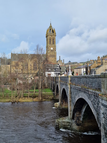
Carlowse Bridge Carlowse Bridge was built in 1783, replacing an earlier brig erected sometime between 1694 and 1741. The bridge was a Category C listed structure until the renovation work that Scottish Borders Council carried out in 2012. The bridge became an important crossing point of the Tweed. Before it was built, the only access to the Kirk had been via a ford and stepping stones near the current Kirk site. The small waterfall above the Bridge is named Carlow’s Linn, and the current bridge name has evolved from the original Carlow’s Brig. It is possible that the word ‘carlow’ comes from the old Scots word ‘carlin’, which is a disparaging term for an old woman: a witch. The falls may originally have been named Witches Linn, and the bridge, Witches Brig. The River Tweed rises at Tweed Wells, in the Lowther Hills in Tweedsmuir just before the boundary to Dumfries and Galloway. Both the River Annan and the Clyde rise near to Tweed Wells, heading in opposite directions. The Tweed is 97 miles/156km long, and flows east across the Scottish Borders before it meets the sea at Berwick-upon-Tweed, just across the border with England. The Tweed drops 1550 ft/472m from source to sea, and a half of this drop occurs in its first 20 miles.
Image 1
Culture and Heritages+2

Logan Iron Age Fort

Culture and Heritages, Sites and Castles, Walks and Activities

A walk back in time, describing the lives of the people who have lived in the Logan Valley for centuries. The Iron Age Fort, later dwellings and other archaeological features of interest are explained as you walk through the hills. It is fascinating to stand where Tweedsmuir residents lived centuries ago, and see the mark they made on the landscape. This walk takes you across rough grassland, open heather hills and includes several steep climbs and descents. There are no clearly defined paths, as the walk takes you along sheep tracks, old drove roads and rough terrain at the furthest end of the walk. Some parts are boggy, and you will walk though areas of heather. The walk up Worm Hill is steep and challenging. There are 4 pedestrian gates on the route. You can choose to split the walk at the bridge over the Logan Burn, making a much easier route.
Image 1
Culture and Heritages+1

Patervan Path

Culture and Heritages, Galleries and Museums

This is a beautiful walk within sight of the River Tweed, and then along one its tributaries, Polmood Burn. You should be able to glimpse plenty of wildlife, including red squirrels, buzzards, hares and maybe even a golden eagle. At the end of the walk the landscape opens up to give spectacular views of some of the highest hills in the Borders, including Broad Law. This walk takes you along well-maintained, coarse gravel farm tracks. The route is way marked by yellow arrows on small green circular signs. You follow a well-made track up the valley and then through the grassland in Polmood Valley. There are options to extend this walk, and you should consult an OS map to plan your walk if you wish. There is a cattle grid with a pedestrian gate, and several gates to go through, which should all be left as you find them.
Image 1
Culture and Heritages+2

Top of Talla Linns

Culture and Heritages, Rivers and Lakes, Walks and Activities

Start/Parking Parking: There is a car parking area near the start of this walk just after you cross the small bridge (if coming from Tweedsmuir), round the corner on the left-hand side of the road. The first part of the walk is on a reasonable track, although some areas are muddy and there are loose stones along the way. After the green shed, the path becomes a bit less defined and boggy. Towards the end of the track you will have to cross a burn, and there is no bridge, and avoid the wetter areas of the path. This final section requires stout footwear and a good level of fitness. Talla Linns is the name of the waterfall that cascades impressively down the hillside. The road here is also known as ‘The Linns’ locally, and is a steep single-track section that often takes visitors to the area unawares. It is untreated through the winter months, making access impossible during the snowy and frosty periods. A very impressive Victorian drainage gully runs down the side of the road. This was cleared and restored by a local volunteer in 2010, and has resulted in much safer driving conditions.
Image 1
Culture and Heritages+2

Fruid Reservoir

Culture and Heritages, Rivers and Lakes, Walks and Activities

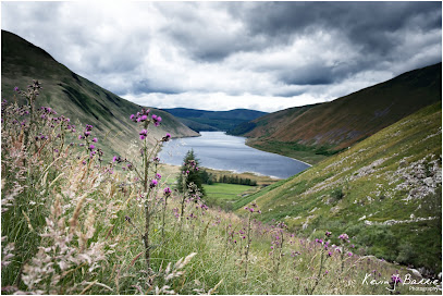
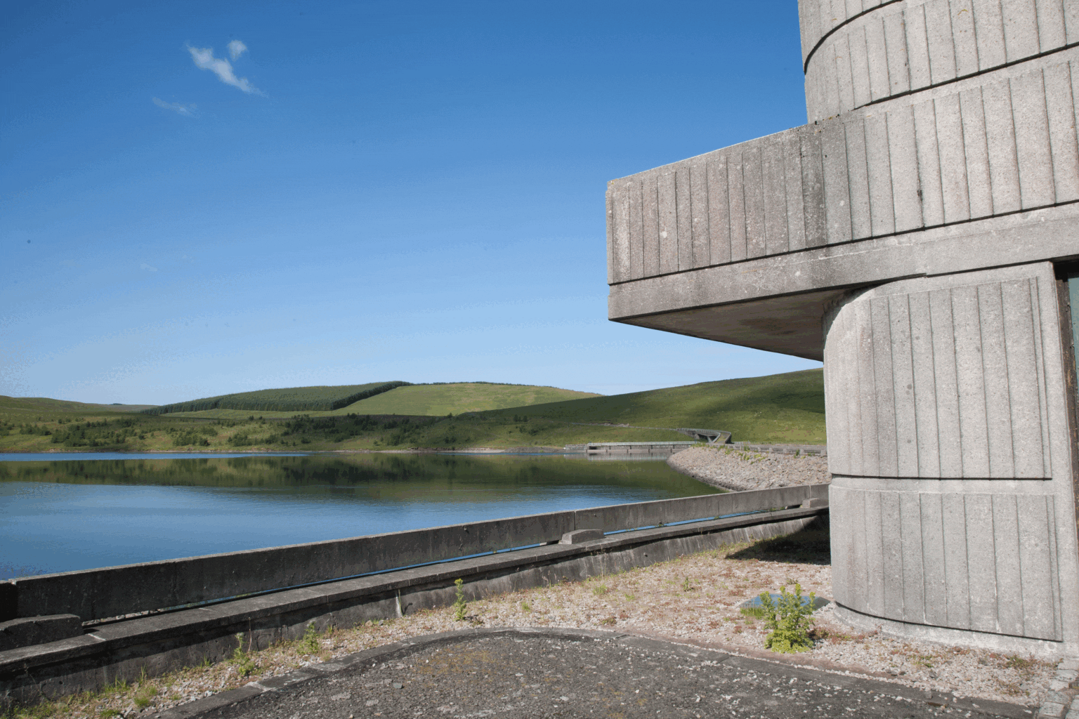
This is a beautiful walk along the banks of Fruid reservoir that will provide some amazing views at any time of the year. The high hills often are reflected beautifully in the reservoir creating some great photo opportunities. This is a gentle walk along the private road that runs along the length of Fruid reservoir to the farms at the top of the Valley. You could then choose to extend your walk by continuing along the other side of the dam, back to the start. The path on this section is not so well defined. You will have to cross cattle grids. Start/Parking Parking: There is car parking at the reservoir at the start of the walk. After parking your car, take the narrow, tarmacked road that runs to the left of the reservoir and follow this road as it winds along the length of the loch. You will pass the unusual concrete building which is the ‘retro’ control house. Fruid Reservoir was formed in the 1960s by damming the Fruid Water. The water from Fruid supplements the contents of nearby Talla Reservoir, and travels through the hillside in a tunnel. This water eventually supplies drinking water to Edinburgh. Fruid Reservoir is quite small, measuring 140 hectares. It is managed by Scottish Water. Construction on the site was completed in 1968. Farmland buildings were sacrificed to build the reservoir (including Fruid, Carterhope and Hawkshaw), and are now underneath the water. New cottages were built as replacements at the end of the reservoir. Carterhope Farm was run by the monks of Melrose Abbey in the 13th-15th Centuries, when Fruid Castle was occupied by the Frasers. The monks were faming cattle and sheep, selling fleeces and hides as well as butter and cheese (from both cow and sheep milk). The goods would have been transported by horse and cart, and local farm names reflect this: Carterhope and Hopecarton both mean ‘valley of the carts’. The monks also had a chapel and a graveyard, now lost under the water, and the baptismal font from this chapel now forms part of the signpost directing travellers at the crossroads in Tweedsmuir Village. The Chapel was located on the banks of Chapel Burn, a tributary of Fruid Water. The playwright Peter Moffat had ancestors who lived in the area that is now under the reservoir. He has cited this location as the inspiration for his 1993 TV series The Village. The series tells the story of life in a Derbyshire village in the early 20th Century.
Image 1
Culture and Heritages+2

Gameshope

Culture and Heritages, Nature and Wildlife, Sites and Castles

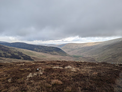
Park and start Park at the end of Talla reservoir, just before the steep road (Talla Linn Foots), on the grassy verge. The walk starts as you pass through the pedestrian gate at the bottom of the valley. There is an information point inside the gate, showing various points of interest. Views The footpath follows the Gameshope burn, and there are spectacular views as you make your way up the valley. The path is generally in good condition, but in some sections, water runs over the path, and there are some rocks and potholes to negotiate. As sections are tarmacked, it can be very slippy underfoot in the winter. Ice Age History This valley was under ice during the last ice age and as you look up the valley you will see the “U” shaped sides, typical of glaciation. Some of the rocks on the sides of the path also have scratch marks on them, that would have been made by rocks carried down the slope in the bottom of the glacier. You will also notice that the hills are rounded, as the glacier would have covered them completely. The river has also done some erosion on the landscape, and about halfway up the valley you will notice small round pockets cut into the rock at the side of the burn. When the burn is in spate, this will have been caused by gravel and grit carried by currents, grinding the rocks within the water. The Dam at Talla The path is tarmacked in places, as stones for the building of the dam at Talla were quarried from here in the early 1900s. There was a railway running the whole north side of Talla reservoir to take the stone to the dam. Some of the quarries can still be seen in Gameshope with piles of whinstone rocks, still in situ, that were ultimately not required during the construction of the dam. If you look carefully at some of the rocks on the top side of the path you will see some holes that were drilled to contain dynamite during quarrying. It is likely that the rocks were transported down the valley to the railway by horse drawn wooden sledges. Once the dam was completed, the railway was removed, and the track bed used as the route of the present vehicular road. The old Shepherd’s cottage at Gameshope Now managed by the Mountain Bothy Association, and is free to stay in overnight. The cottage was formerly owned by the Anderson family, and was bequeathed to the Bothy Association. To reach the bothy, you have to wade across the burn, which is not advisable when the water level is high. For centuries Talla and Gameshope was an upland sheep farm. There used to be 6 full time shepherds working here, and Gameshope was home to one or two of these men, with their families. Gameshope was purchased by Scottish Borders Trust in 2013, and all the sheep have been removed. Just beyond the bothy, past the farm shed, there is a rocky natural structure, that appears from a distance to resemble a stony fortress. Is this the site of Gameshope Castle? Peden’s Pulpit In the hills behind Gameshope Castle is Peden’s Pulpit. Grid reference: NT137183. Peden’s pulpit is a natural stone and is where Prophet Peden preached to his congregation of local covenanters, hidden from Claverhouses’s men. If you stand on top of the “pulpit’ it is easy to imagine the congregation of local covenanters gathered below, listening to his sermon.

Image 1
Nature and Wildlife+1

Sycamore Gap

Nature and Wildlife, Sites and Castles

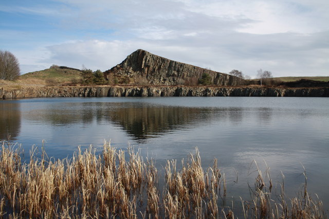
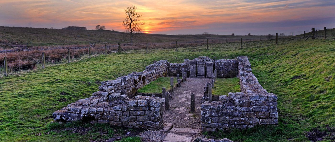
The latest on the tree The Sycamore Gap tree was one of the most photographed in the country before it was felled in October 2023. The tree stood in a dramatic dip in Hadrian’s Wall in the Northumberland National Park, and in late 2016, it took the crown for English ‘Tree of the Year’ in the Woodland Trust’s awards. Following its felling, an update on how Northumberland National Park is responding to the public outcry can be read here: Sycamore Gap Update. Recently, we announced the artists who have been appointed on a creative commission to install the largest section of the Sycamore Gap tree at The Sill. The National Trust gave the Park the largest section of wood from the trunk salvaged from the tree when it was removed from site. The artists installed the section of trunk at The Sill: National Landscape Discovery Centre a year on from when the tree was felled. At the Sycamore Gap site The Roman Milecastle 39 is just to the left. It’s known as Castle Nick, as it sits in a nick in the hillside. The site was excavated between 1908 and 1911 and re-excavated between 1982 and 1987. In the south-east corner was a stone oven and the south-west corner a rectangular building with a sunken floor associated with Roman finds. The milecastle appears to have been occupied until the late 4th century. In the 18th century, a possible milking house was built in the west corner. The land at Sycamore Gap is looked after by both Northumberland National Park and the National Trust.
Image 1
Rivers and Lakes+2

Housesteads Roman Fort

Rivers and Lakes, Sites and Castles, Walks and Activities

Take an atmospheric wander around the best-preserved Roman fort in Britain. Housesteads Roman Fort was once garrisoned by 1,000 soldiers. It is aligned towards sunrise, making the east gate the main gate. You can still see the deeply worn wheel ruts here. Vercovicium or Borcovicium were how the fort was known in Roman times. The museum and its introductory film give great insight about these astonishing ruins. The steep walk to the remains is worth it for the history and spectacular views. From 1663, Housesteads was the home of the Armstrongs, notorious Border Reivers. Nicholas Armstrong bought the farm in 1692, only to have to sell it again in 1694 to Thomas Gibson, of Hexham, for £485. The Armstrongs remained as tenants. They were well-known horse thieves and cattle rustlers, who used the old Roman fort as a corral for their stolen livestock. They “traded” all over. At one time, every male member of the family had been outlawed by English or Scottish authorities. Nicholas was hanged in 1704, and his brothers fled to America. The Armstrongs lived in a typical 16th century defensive bastle house of two storeys: the ground floor for livestock and the upper level for living quarters. Its ruins remain built up against the south gate of the Roman fort and clearly show its defensive nature, with external stone steps and narrow loop windows. A corn-drying kiln was inserted into the gate’s guard chamber in the 17th century.
Image 1
Nature and Wildlife+1

Kielder Art & Architecture

Nature and Wildlife, Walks and Activities

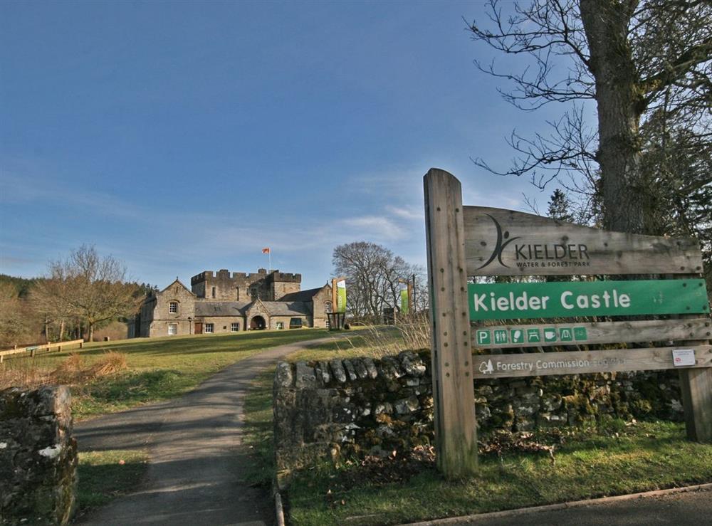
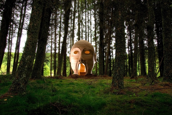
Over the past 27 years, the landscape around Kielder Water & Forest Park has become home to a unique collection of visual art and architecture, inspiring the creation of work in response to the scale and complexity of its unique environment and the area's varied and fascinating history. Many people visit the park for this open-air art experience, located at sites around the lake, in the forest, and within Northumberland National Park. You might choose to visit the award winning futuristic shelter ‘Kielder Belvedere’ by Softroom Architects; experience James Turrell’s light sculpture ‘Kielder Skyspace’; discover the story of Freya and Robin in Studio Weave’s ‘Freya’s Cabin’; or contemplate the play of water on the waves in Chris Drury’s ‘Wave Chamber’. There are many other varied works of art and architecture including the ‘Bakethin Hide’, a wildlife watching space delivered in collaboration with Newcastle University’s School of Architecture as part our Testing Ground programme. Between May and November why not visit The Nick, situated at the highest point of Forest Drive that links Kielder village with the A696 to the east. The Nick is designed to provide a variety of shelter and seating alternatives from which different aspects of the landscape can be viewed. Download a Travelling Tales guide below to help make the most of your trip along the Forest Drive. For more information see http://www.visitkielder.com/public-art/the-nick-&ssid=1256116 Most pieces are fully accessible to visitors and along the Lakeside Way there is the opportunity to explore many of these contemporary works, including the three large rotating Janus Chairs and the ever-popular Silvas Capitalis, also known as the 'giant forest head'! PLEASE NOTE There is currently no access to Janus Chairs. due to it requiring repairs and maintenance so for visitors safety, there is currently no access.